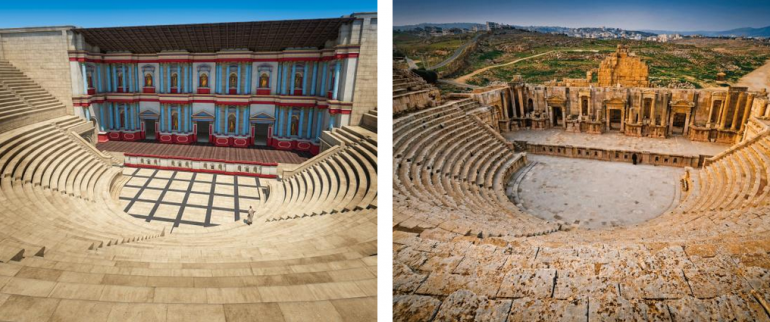
Jerash, located in modern Jordan, was one of the “10 Cities”, the Decapolis, mentioned in the Gospels (see references to Decapolis here and specific mentions of Jerash [Gerasa] here). National Geographic, as always, does a fantastic job of of a visual presentation, with photos and reconstructions of the ancient city, as well as giving an overview of the history of the location. I have yet to visit Jerash, but I hope to in the near future.
From the full article:
The existence of the King’s Highway can be traced back to the Bronze Age. This royal route was central to trade in the Middle East, connecting Egypt via the Gulf of Aqaba on the Red Sea all the way north to Damascus. No great empire was centered along this road, but the cities along it grew rich from commerce, as traders bearing grain from Egypt, incense from Yemen, pearls from the Red Sea, and spices from India traveled along the King’s Highway.
One of the greatest cities was Jerash, founded as Greek culture was spreading across the region. Enriched by trade, Jerash was shaped by waves of conquerors until it was absorbed by the eastward expansion of Rome. Lying 30 miles north of the Jordanian capital Amman, today Jerash is prized as one of the best preserved of the Roman Decapolis, the 10 Hellenistic cities clustered along the empire’s eastern border
[Post header image from the article: ILLUSTRATION: JOSEP RAMON CASALS (Left) and Photograph by jochen schlenker/age fotostock (Right)]
